Will it snow in Manchester? Manchester Airport and Network Rail issue statements as temperatures drop

and live on Freeview channel 276
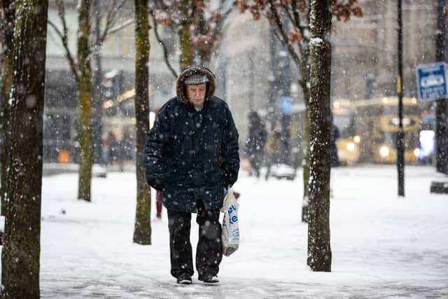
Greater Manchester is in the midst of a yellow Met Office weather warning. Although in place for snow, the worst of the weather has come in the form of heavy rain.
The warning came into place at 3am this morning (February 8) and is currently set to stay in place until 3am on February 9. Heavy rain and a ‘feels like’ temperature of as low as -4C has made for a gloomy morning.
Advertisement
Hide AdAdvertisement
Hide AdWith the aim of keeping people on the move, transport hubs around the region have issued their latest advice. We’ve rounded up what we know so far, including the latest statement issued by Manchester Airport.
Latest from Manchester Airport
A spokesperson for Manchester Airport said: “The cold weather is on its way, and our teams are on standby to minimise any disruption caused by potential snowfall. Please take care when travelling to the airport and check with your airline for up-to-date travel advice.”
Train travel advice
As rain and cold conditions hit the North West, Network Rail has issued information for people travelling on the network. At present, there are no issues on the trains around Greater Manchester, but Network Rail have advised customers to check in on their route at National Rail.
National Highways

People taking to roads across the region will be able to check their status through the National Highways website. The agency has issued their latest update on their website
Advertisement
Hide AdAdvertisement
Hide AdThe latest information reads: “Snow will develop in the south of the North West and North East regions early this morning, persisting throughout the day, though turning erratically to rain from the south. This could happen quite quickly on lower routes with limited amounts of wet snow falling, whilst for higher routes above 200 m perhaps taking till afternoon and persisting as snow on the highest parts of the Pennine routes. This will leading to a steep increase in the amounts of snow at higher elevations compared to lower elevations.”
Manchester weather forecast
February 8
A chilly and frosty start for some, however turning increasingly cloudy with outbreaks of heavy rain arriving from the south, turning to sleet and snow at times, especially over the higher ground further east. Feeling cold with a brisk wind. Maximum temperature 5C.
Remaining unsettled this evening and overnight with outbreaks of heavy rain and snow at times accompanied by strong, gusty winds. Feeling cold. Minimum temperature -2C.
February 9
Staying cloudy with outbreaks of rain and possible snow moving northwards through the day. Winds gradually easing from the south through the afternoon. Maximum temperature 7C.
A mixture of some brighter and drier intervals at times, though still a risk of showers or longer spells of rain. Generally lighter winds with temperatures close to average.
Comment Guidelines
National World encourages reader discussion on our stories. User feedback, insights and back-and-forth exchanges add a rich layer of context to reporting. Please review our Community Guidelines before commenting.