Manchester weather forecast as yellow weather warning for snow and ice in place across the region

and live on Freeview channel 276
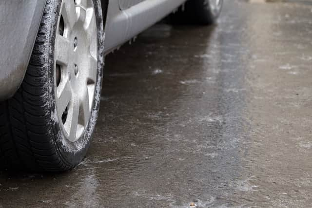
Manchester wakes up to yet another sunny, but cold and wintry morning, as the Met Office has a yellow weather warning in place for Wednesday and Thursday. For 24 hours, the Greater Manchester area might experience wintry showers and ice which may lead to disruptions and accidents.
Wednesday (January 18) starts off with a clear, dry and frosty morning with temperatures around freezing, and a few wintry showers in the far southwest of the region. Winds will be a bit stronger than we have been experiencing over the past few days, especially near the coasts, and temperatures won’t go above 6°C.
Advertisement
Hide AdAdvertisement
Hide AdLater on throughout the evening, the clear sky is getting increasingly cloudy from the west and wintry showers sweep across the North West. The winds will slow down slightly overnight and as temperatures drop to -2°C, frost will form.
A yellow weather warning for snow and ice is in place from 12:00 Wednesday to 12:00 Thursday. The warning brings risks of delay on roads and railways which may lead to longer travel times, and increased risk of injury from slips and ice on icy surfaces and untreated roads and pavements.
Another cold and frosty morning awaits on Thursday (January 19), and the day will be mostly cloudy and with wintry showers. The weather is looking to clear up through the day with dryer and sunnier weather in the afternoon and temperatures around 6°C.
Friday will once again be sunny and dry with cold temperatures. But clouds are coming in from the west over the weekend bringing with it some rainy patches but warmer temperatures.
Advertisement
Hide AdAdvertisement
Hide AdNorth West England weather forecast
Today (January 18):
A cold and frosty, locally icy start to a mostly dry and largely sunny day, with only a few wintry showers in the far southwest. Windier than recent days, especially around coasts and feeling particularly cold. Maximum temperature 6 °C.

Tonight:
Mostly dry and clear for the first half of the evening, but cloud increasing from the west to bring wintry showers overnight. Brisk winds slowly easing, and some frost forming. Minimum temperature -2 °C.
Thursday:
Another cold and frosty start. Mostly cloudy for a time with wintry showers, although tending to become drier and brighter through the day. Chilly, and a little breezy at times. Maximum temperature 6 °C.
Outlook for Friday to Sunday:
Dry and sunny on Friday after a frosty start. Turning cloudier from the west during the weekend with some patchy rain, and temperatures recovering slowly thanks to a southerly wind. (Source: Met Office)
Comment Guidelines
National World encourages reader discussion on our stories. User feedback, insights and back-and-forth exchanges add a rich layer of context to reporting. Please review our Community Guidelines before commenting.