
The major changes and new routes changing how people travel around parts of Greater Manchester

Big changes are coming to Salford to make it easier to walk and cycle around the city. New routes are being made to boost active travel in key areas, such as places with lots of residential streets and areas used by commuters and businesses.
There are also public transport upgrades, with the new number 30 bus route connecting the Trafford Centre and Manchester via Trafford Park, MediaCity, and Ordsall Lane.
It comes as parts of Salford are dealing with heavy traffic and parking problems on some roads.
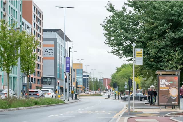

A new scheme in the pipeline would see £4m spent on upgrades on roads around Ordsall, a neighbourhood sandwiched between Salford Quays and Manchester city centre.
The council has shared a list of Ordsall roads which could benefit from the cash and see major improvements.
Money to fund the scheme has come from the City Region Sustainable Transport Settlements (CRSTS) programme.
This is after recent changes to a stretch of Chapel Street, where there are brand new cycling paths on the busy city centre route, and other major infrastructure projects on the way such as the landmark Salford Rise bridge.
With much happening in the city to boost active travel, the Local Democracy Reporting Service (LDRS) spoke to Councillor Mike McCusker, the town hall’s lead on transport matters, about the changes taking place.
“As part of the council’s broader goals of creating a greener, fairer and healthier city, we want to create a vibrant and sustainable place that people can enjoy that makes a real difference to how they experience our city,” he said.
“Connecting communities through better active travel links and networks is part of our vision to improve movement and connectivity in Salford and our wider regeneration plans.
“Investing and improving the active travel network also includes promotion of safe, sustainable school travel reflected in the Safe Streets element of the GM [Greater Manchester] Vision Zero Strategy, which has the aspiration of preventing road deaths and life-changing injury across GM and the GM Transport Strategy which aims to increase the number of journeys made by public transport and active travel.”
Here are the roads in Ordsall which could see major changes under Salford council’s new plans.
Eccles New Road, Howard Street, and King William Street
A new toucan crossing is proposed for pedestrians and cyclists on Eccles New Road, as well as adding dedicated cycle lanes, speed bumps on the road, and resurfacing the carriageway.
It could also get a new parking area created for those using local shops, and double yellow lines put down in some places to improve traffic flow.
On Howard Street, the council said it is looking at footway resurfacing, kerbing, and road markings for safer and clearer paths.
Changes on the street also include new shared-use footways for both cyclists and pedestrians to use, and a 20mph speed limit zone.
King William Street could see the footway widened to make more space for pedestrians, and a shared footway/cycleway introduced at designated start and end points.
The carriageway would be reduced to slow traffic and prioritise walking and cycling, and double yellow lines proposed on some areas of the street.
Gloucester Street, Goodiers Drive, Robert Hall Street
Changes on Gloucester Street, off Regent Road, are aimed at improving pedestrian safety and managing traffic flow.
It includes a raised junction with uncontrolled crossing points for pedestrians, new traffic calming measures to lower speeds, and new parking restrictions on a resurfaced carriageway.
On Goodiers Drive, the footway could be widened and new crossings installed. Traffic calming measures are also part of the plans, as well as new planting to manage the impact of rainfall.
Robert Hall Street could get upgrades to its existing bus stops to level access, and new parking restrictions with a maximum stay of three hours, and no return within one hour.
That’s alongside proposals for raised junctions to improve pedestrian safety, and new crossings.
Colman Gardens, Ordsall Park, Phoebe Street, West Craven Street
Hulton Street, by Ordsall Park, is the focus of new improvements too.
Changes include a new link to Trafford Road’s cycle path, with the aim of improving connectivity to the network, as well as a new ramp and crossing point on the street.
Where needed, the road surface will be reinstated with gulley replacement planned to improve the drainage and road quality.
The existing parking bays on the street are set to stay.
The footpath in Ordsall Park could be widened to 3m and become a shared-use footpath/cycleway, with a raised junction to be made on New Park Road for safer walking and cycling links to the park area.
The pedestrian walkway next to the park could be cleaned and relaid where needed, for better accessibility.
Changes are also planned around West Park Street, Colman Gardens and Phoebe Street to improve pedestrian and cyclist safety, public spaces, and calm traffic.
Oldfield Road, Ordsall Lane, Taylorson Street
On Ordsall Lane, there are plans for new crossings and for the carriageway width to be reduced with islands for safer crossings, and new bus stops introduced, with some existing stops relocated or removed.
There could be a new one-way system on Worrall Street, including no-entry signs and build-outs.
On Taylorson Street, the proposals could see a new quietway route linking to Exchange Quay tram stop, and a shared-use footway/cycleway with defined start and end points.
There is a proposed 20mph speed limit for Taylorson Street South, and new high-friction surfacing on the road for better grip and safety.