
Tens of thousands more Greater Manchester homes to be at risk from flooding: Full list of every area affected

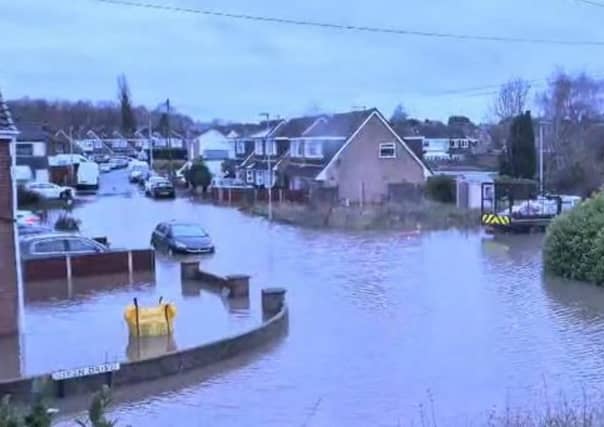

Thousands more Greater Manchester households could be at risk from the impacts of flooding in the next 25 years unless action is taken, new research has shown.
Aviva’s Building Future Communities report brings together the latest data to outline the risks that homes could face from multiple climate threats by
2050 and beyond, including flooding, subsidence and extreme heat.
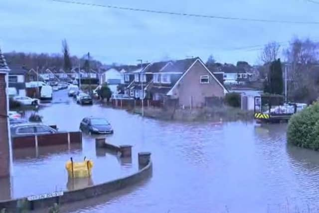
Surface water flooding is predicted to threaten tens of thousands more homes in Greater Manchester.
The report states that of the 75,869 households in the Manchester Central constituency, 15,989 are currently at risk from river or surface water flooding.
By 2050, the report suggests that figure will rise to 20,418, meaning 27 per cent of households would be a risk.
Similarly in the Salford constituency, where there are 70,774 homes, by 2050, 31,081 are predicted to be at risk of flooding, a whopping 44 per cent of households.
Surface water flooding– or flash floods – which are harder to predict and protect against, are also likely to increase.
Environment Agency data suggests the number of properties at risk in England could rise to 6.1 million between 2040 and 2060, including a 66 per cent rise in the number of properties at high risk.
According to Aviva’s analysis, urban and densely populated areas, including Manchester, London and areas of the North East, could be hotspots for surface water flooding in future due to the greater prevalence of hard surfaces, which can prevent rainwater from draining.
According to the report, some of the UK’s most well-known landmarks, including Cardiff Bay, York city centre and Liverpool waterfront, could be vulnerable to flooding because of rising sea levels, heavier rainfall and more frequent weather events.
Jason Storah, CEO UK & Ireland General Insurance, Aviva, said: “In the UK we have seen the impacts of our changing climate and this year is no exception.
“Record temperatures, wildfires and flash flooding have affected lives across the globe and it is clear that action is needed to adapt to the increasing frequency of these events.
“Our Building Future Communities report lays bare the risks that homes and businesses could experience by 2050.
“The findings are stark. Millions more properties could be at risk from flooding, with rising temperatures, increased urbanisation and inadequate drainage exacerbating the risks in future.”
Using Aviva’s data, the Local Democracy Reporting Service has broken down the figures in every parliamentary constituency in Greater Manchester to illustrate the rising proportion of properties at risk from flooding:
Bolton
Bolton North East
- Number of households in constituency 53111
- Number of properties with river or surface water flood risk in 2025 6739
- Number of properties with river or surface water flood risk in 2050 8948
- Proportion of properties with flood risk in 2025 (%) 12.7
- Proportion of properties with flood risk in 2050 (%)16.8
Bolton South and Walkden
- Number of households in constituency – 53213
- Number of properties with river or surface water flood risk in 2025 – 6897
- Number of properties with river or surface water flood risk in 2050 – 9131
- Proportion of properties with flood risk in 2025 (%) – 13.0
- Proportion of properties with flood risk in 2050 (%) – 17.2
Bolton West
- Number of households in constituency – 46319
- Number of properties with river or surface water flood risk in 2025 – 5786
- Number of properties with river or surface water flood risk in 2050 – 7591
- Proportion of properties with flood risk in 2025 (%) – 12.5
- Proportion of properties with flood risk in 2050 (%) – 16.4
Bury
Bury North
- Number of households in constituency – 48038
- Number of properties with river or surface water flood risk in 2025 – 6822
- Number of properties with river or surface water flood risk in 2050 – 8838
- Proportion of properties with flood risk in 2025 (%) – 14.2
- Proportion of properties with flood risk in 2050 (%) – 18.4
Bury South
- Number of households in constituency – 47178
- Number of properties with river or surface water flood risk in 2025 – 7314
- Number of properties with river or surface water flood risk in 2050 – 8867
- Proportion of properties with flood risk in 2025 (%) – 15.5
- Proportion of properties with flood risk in 2050 (%) – 18.8
Manchester
Blackley and Middleton South
- Number of households in constituency – 47989
- Number of properties with river or surface water flood risk in 2025 – 6216
- Number of properties with river or surface water flood risk in 2050 – 7976
- Proportion of properties with flood risk in 2025 (%) – 13.0
- Proportion of properties with flood risk in 2050 (%) – 16.6
Gorton and Denton
- Number of households in constituency – 48421
- Number of properties with river or surface water flood risk in 2025 – 7401
- Number of properties with river or surface water flood risk in 2050 – 9600
- Proportion of properties with flood risk in 2025 (%) – 15.3
- Proportion of properties with flood risk in 2050 (%) – 19.8
Manchester Central
- Number of households in constituency – 75869
- Number of properties with river or surface water flood risk in 2025 – 15989
- Number of properties with river or surface water flood risk in 2050 – 20418
- Proportion of properties with flood risk in 2025 (%) – 21.1
- Proportion of properties with flood risk in 2050 (%) – 26.9
Manchester Rusholme
- Number of households in constituency – 45923
- Number of properties with river or surface water flood risk in 2025 – 12029
- Number of properties with river or surface water flood risk in 2050 – 17842
- Proportion of properties with flood risk in 2025 (%) – 26.2
- Proportion of properties with flood risk in 2050 (%) – 38.9
Manchester Withington
- Number of households in constituency – 39728
- Number of properties with river or surface water flood risk in 2025 – 10850
- Number of properties with river or surface water flood risk in 2050 – 14037
- Proportion of properties with flood risk in 2025 (%) – 27.3
- Proportion of properties with flood risk in 2050 (%) – 35.3
Wythenshawe and Sale East
- Number of households in constituency – 51063
- Number of properties with river or surface water flood risk in 2025 – 10232
- Number of properties with river or surface water flood risk in 2050 – 14704
- Proportion of properties with flood risk in 2025 (%) – 20.0
- Proportion of properties with flood risk in 2050 (%) – 28.8
Oldham
Oldham East and Saddleworth
- Number of households in constituency – 46447
- Number of properties with river or surface water flood risk in 2025 – 5566
- Number of properties with river or surface water flood risk in 2050 – 7754
- Proportion of properties with flood risk in 2025 (%) – 12.0
- Proportion of properties with flood risk in 2050 (%) – 16.7
Oldham West, Chadderton and Royton
- Number of households in constituency – 46245
- Number of properties with river or surface water flood risk in 2025 – 5428
- Number of properties with river or surface water flood risk in 2050 – 7398
- Proportion of properties with flood risk in 2025 (%) – 11.7
- Proportion of properties with flood risk in 2050 (%) – 16.0
Rochdale
Heywood and Middleton North
- Number of households in constituency – 47297
- Number of properties with river or surface water flood risk in 2025 – 4583
- Number of properties with river or surface water flood risk in 2050 – 6183
- Proportion of properties with flood risk in 2025 (%) – 9.7
- Proportion of properties with flood risk in 2050 (%) – 13.1
Rochdale
- Number of households in constituency – 45031
- Number of properties with river or surface water flood risk in 2025 – 5970
- Number of properties with river or surface water flood risk in 2050 – 7766
- Proportion of properties with flood risk in 2025 (%) – 13.3
- Proportion of properties with flood risk in 2050 (%) – 17.2
Salford
Salford
- Number of households in constituency – 70774
- Number of properties with river or surface water flood risk in 2025 – 25897
- Number of properties with river or surface water flood risk in 2050 – 31081
- Proportion of properties with flood risk in 2025 (%) – 36.6
- Proportion of properties with flood risk in 2050 (%) – 43.9
Worsley and Eccles
- Number of households in constituency – 51298
- Number of properties with river or surface water flood risk in 2025 – 9802
- Number of properties with river or surface water flood risk in 2050 – 14156
- Proportion of properties with flood risk in 2025 (%) – 19.1
- Proportion of properties with flood risk in 2050 (%) – 27.6
Stockport
Cheadle
- Number of households in constituency – 43287
- Number of properties with river or surface water flood risk in 2025 – 8412
- Number of properties with river or surface water flood risk in 2050 – 10791
- Proportion of properties with flood risk in 2025 (%) – 19.4
- Proportion of properties with flood risk in 2050 (%) – 24.9
Hazel Grove
- Number of households in constituency – 44660
- Number of properties with river or surface water flood risk in 2025 – 6565
- Number of properties with river or surface water flood risk in 2050 – 8682
- Proportion of properties with flood risk in 2025 (%) – 14.7
- Proportion of properties with flood risk in 2050 (%) – 19.4
Stockport
- Number of households in constituency – 52128
- Number of properties with river or surface water flood risk in 2025 – 7419
- Number of properties with river or surface water flood risk in 2050 – 9776
- Proportion of properties with flood risk in 2025 (%) – 14.2
- Proportion of properties with flood risk in 2050 (%) – 18.8
Tameside
Ashton-under-Lyne
- Number of households in constituency – 47430
- Number of properties with river or surface water flood risk in 2025 – 7413
- Number of properties with river or surface water flood risk in 2050 – 9491
- Proportion of properties with flood risk in 2025 (%) – 15.6
- Proportion of properties with flood risk in 2050 (%) – 20.0
Stalybridge and Hyde
- Number of households in constituency – 46280
- Number of properties with river or surface water flood risk in 2025 – 6801
- Number of properties with river or surface water flood risk in 2050 – 9501
- Proportion of properties with flood risk in 2025 (%) – 14.7
- Proportion of properties with flood risk in 2050 (%) – 20.5
Trafford
Altrincham and Sale West
- Number of households in constituency – 45020
- Number of properties with river or surface water flood risk in 2025 – 8486
- Number of properties with river or surface water flood risk in 2050 – 13086
- Proportion of properties with flood risk in 2025 (%) – 18.8
- Proportion of properties with flood risk in 2050 (%) – 29.1
Stretford and Urmston
- Number of households in constituency – 49137
- Number of properties with river or surface water flood risk in 2025 – 6396
- Number of properties with river or surface water flood risk in 2050 – 9335
- Proportion of properties with flood risk in 2025 (%) – 13.0
- Proportion of properties with flood risk in 2050 (%) – 19.0
Wigan
Leigh and Atherton
- Number of households in constituency – 53471
- Number of properties with river or surface water flood risk in 2025 – 9384
- Number of properties with river or surface water flood risk in 2050 – 11300
- Proportion of properties with flood risk in 2025 (%) – 17.5
- Proportion of properties with flood risk in 2050 (%) – 21.1
Makerfield
- Number of households in constituency – 47393
- Number of properties with river or surface water flood risk in 2025 – 7225
- Number of properties with river or surface water flood risk in 2050 – 9014
- Proportion of properties with flood risk in 2025 (%) – 15.2
- Proportion of properties with flood risk in 2050 (%) – 19.0
Wigan
- Number of households in constituency – 52189
- Number of properties with river or surface water flood risk in 2025 – 7689
- Number of properties with river or surface water flood risk in 2050 – 9664
- Proportion of properties with flood risk in 2025 (%) – 14.7
- Proportion of properties with flood risk in 2050 (%) – 18.5