Greater Manchester town issued red flood warning with flooding ‘expected’- Met Office weather forecast

and live on Freeview channel 276
A red flood warning has been issued for parts of a Greater Manchester town. The warning has been placed on Horwich by the Environment Agency.
The warning comes as heavy rain falls around the Greater Manchester and wider North West region. Today (November 6) the heavy rain is set to last until well into the evening.
Advertisement
Hide AdAdvertisement
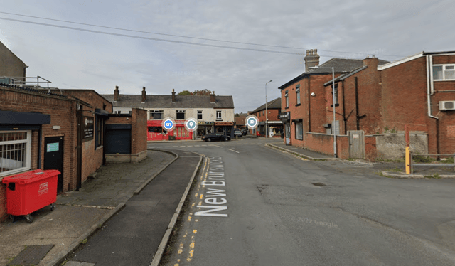
Hide AdThe warning is currently covering Horwich town centre from Bridge Street and Old Station Park to the M61, homes and businesses on Winter Hey Lane, Mason Street and adjoining roads including St. John Street, New Brunswick Street, Emmett Street, Taylor Street and Chorley New Road.
An Environment Agency spokesperson said: “Please take action to protect yourself and your property and monitor local weather and river conditions. Avoid contact with, walking or driving through flood water. Consider activating any property flood protection products you may have.
“Environment Agency Flood Warning Officers set the river or tidal levels that have triggered this message. During industrial action this message has been automatically issued based on rising river or tidal levels.”
Met Office weather forecast for North West England
November 6
Another day of sunny spells and scattered showers. The showers will be heavy in places with a chance of thunder. Feeling fairly cool in the blustery westerly winds. Maximum temperature 11C.
Advertisement
Hide AdAdvertisement
Hide AdFurther heavy showers overnight, these most frequent in coastal areas, but pushing inland at times. Some clearer interludes in between the showers. Staying quite breezy, and largely frost free. Minimum temperature 5C.

November 7
Showers, often heavy, with sunny intervals during the morning. Becoming somewhat drier during the afternoon, with the showers gradually turning more isolated and less heavy. Staying rather breezy. Maximum temperature 11C.
A wet and very windy start on Wednesday but turning drier through the morning with some afternoon brightness. Sunshine and blustery showers on Thursday, then drier and brighter on Friday.